Bulgarian sights
National park Sinite kamani
The national park is located on the southern slopes of the Balkans Mountain. Its square surface is about 11 400 sq.m. and is part of the protected areas in the country.
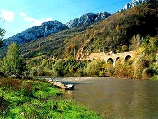
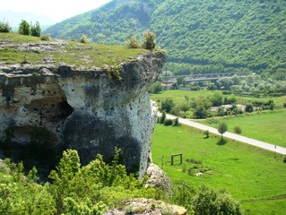
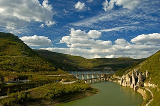
Natural Park 'Rusenski Lom'
Natural Park 'Rusenski Lom' is situated on the banks of Rusenski Lom River. The river passes by picturesque places such as Ivanovski rock monasteries, the medieval town of Cherven and the only operational rock monastery in Bulgaria in village of Basarbovo.
NATURAL PARK VRACHANSKI BALKAN
The Natural park “Vratchanski Balkan” occupies the biggest area of the Vrachanska mountain and the massive of the Lakatnishkite skali. Its territory includes the town of Vratsa
Nunnery "Pokrov Bogorodichen"
The Samokovski monastery "Pokrov Bogorodichen" is working monastery and is part of the list of the 100 Tourist Sites of Bulgaria
See on the map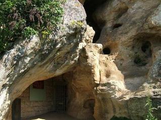
Orlova Chuka cave
Orlova Chuka cave is a national tourist site situated in the picturesque left slope of Cherni Lom River, near town of Dve mogili, Ruse region
See on the map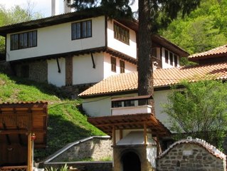
Osenovlashki monastery "Rozhdestvo Bogorodichno"
Osenovlashki monastery "Rozhdestvo Bogorodichno" famous also as Sedemte prestola (the Seven altars) is one of the most beautiful and visited monasteries in the country
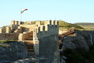
Ovech Fortress
One of the oldest fortresses in Bulgaria located on a high mountain plateau above the town of Provadiya
See on the map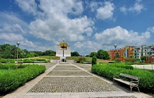
Pantheon of the National Revival
The Pantheon of the National Revival in the town of Ruse is a national monument-ossuary, part of the 100 National tourist sites of the Republic of Bulgaria
See on the map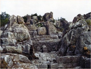
Perperikon
Perperikon (or Hyperperakion or Perperakion) is in the Eastern Rhodope range, some 10 miles from the town of Kurdzhali. The roads from Sofia, via Asenovgrad or Haskovo, are fairly good and well maintained.
See on the map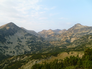
Pirin National Park
Pirin National Park is one of the three national parks in Bulgaria. It was created in 1962 as Vihren National Park. Today the park occupies more than 42 000 ha of the most beautiful mountain in Bulgaria - Pirin.
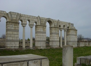
Pliska - The First Bulgarian capital
The town used to be the main political, military, economic and cultural centre from the foundation of the Bulgarian State in 681 till 893.
See on the map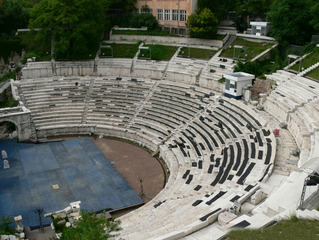
Plovdiv Museum Town
An ancient crossroads between East and West and Bulgaria's second largest city today, Plovdiv has preserved unique treasures from its 24 centuries long history.
Protected area "Oreshari"
The picturesque area "Oreshari" is located near the village bearing the same name in Kardzhali Region and is declared protected in order to preserve the habitats and the populations of engangered palnt and animal spieces
See on the map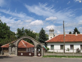
Rakovitsa monastery Sveta Troitsa
Rakovitsa monastery Sveta Troitsa was was found in X-XI century and during the Middle Ages was an important literary and cultural center in Bdin area.
See on the map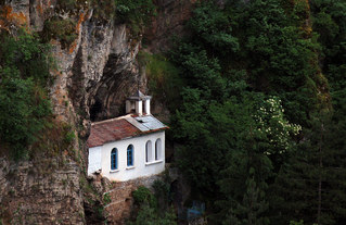
Razboishki monastery "Vavedenie Bogorodichno"
Razboishki monastery "Vavedenie Bogorodichno" is rock monastery situated near the flow of Nishava river and in proximity to Razboishte village
See on the mapRegional History Museum - Stara Zagora town
The Regional History Museum in Stara Zagora town is one of the oldest museums in Bulgaria and one of the largest in Europe.
See on the map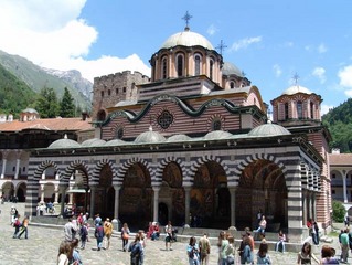
Rila Monastery
The Rila monastery lies in the very Rila mountain, at 1,147 meters above sea level. It is situated 117km away from Sofia to the south, and is no doubt the most popular tourist site among all monasteries in Bulgaria equally for its size, natural surroundings, architecture, wall paintings and ancient history.
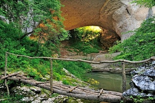
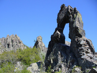
Rock phenomenon "God's bridge"
Natural rock bridge near the town of Vratsa
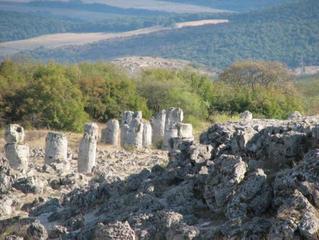
Rock phenomenon "The Wonderful Rocks"
A unique natural phenomenon located near the village of Asparuhovo, Varna Region
See on the map